NASA mapped the earthquake with images from satellite
After the 7.7 and 7.6 magnitudes earthquakes in Türkiye, NASA has published some maps of the regions where the earthquake occurred. Damaged areas, landslides and displacements across the continent were shown on maps.
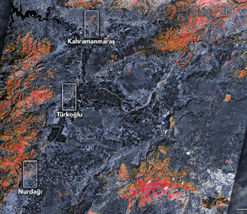
NASA mapped the damaged areas. The following statement was made about the map: "The preliminary damage map shows the regions in Kahramanmaras, Turkoglu and Nurdagi. The parts marked with dark red dots show possible severe damage to buildings and infrastructure or possible changes in the natural appearance of the area. The parts marked with orange and yellow show less and partially damaged areas. Each dot is approximately 30 meters in diameter."
The Singapore Earth Observatory has mapped areas likely to be damaged by earthquakes.

Scientists working with NASA have published a displacement map. In this map, the areas where the soil has been displaced are shown in bold.

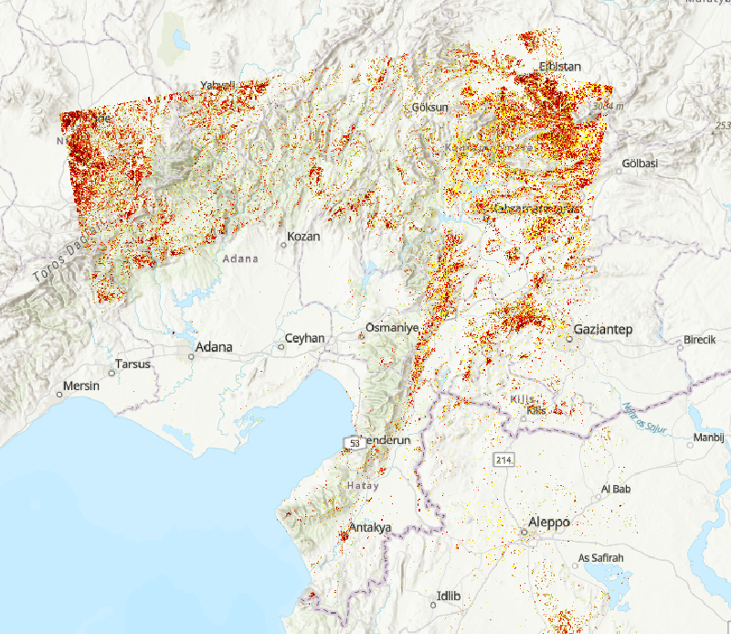
The NASA landslide team mapped the landslides that took place after the earthquakes. The areas indicated with dots on the map are only some of the landslides that have occurred.

In addition, the Ministry of Environment, Urbanization and Climate Change published unmanned aerial vehicle (UAV), drone and Göktürk satellite images of 10 provinces affected by earthquakes in Kahramanmaras. In the written statement made by the Ministry, it was noted that the images and coordinate information obtained with the 3D digital city twin technology were compared with the images taken by 12 UAVs, drones and satellites in 10 provinces damaged in the earthquake.

It was stated that the numbering and population data in the cadastre and Spatial Address Registration System (MAKS) of the buildings damaged by the digital city twin technology were matched with the notification data added to the system and integrated into the ATLAS system, and thus, the number of people residing in the collapsed buildings was made available to all teams in charge of the earthquake.